Shop

-
Software
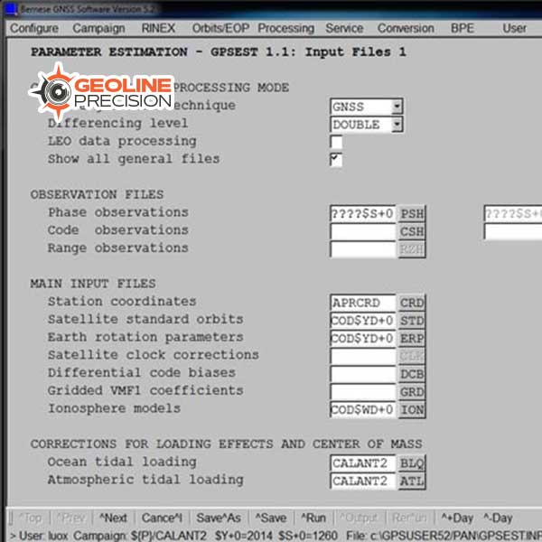
Bernese GNSS Software
$ 0.00The Bernese GNSS Software is the ideal tool for:
- Scientists researching in geodesy, meteorology and geosciences
- University study
- Survey agencies responsible for high-accuracy GNSS surveys
- Agencies responsible for maintenance of arrays of permanent GNSS receivers
- Commercial users with complex applications demanding high accuracy, reliability and high productivity
-
Software
GeoCloud Drive Cloud Storage and Data Transfer Service
$ 0.00GeoCloud Drive is a service within HxGN GeoCloud, a powerful cloud-based collaboration portal. Offering expanding services for optimising work and dataflows, HxGN GeoCloud is powered by HxDR, Hexagon’s cloud-native platform for geospatial solutions at any scale.
-
Software
HxGN GeoMonitoring Hub
$ 0.00Slope movement has always posed one of the biggest risks in mining; making slope monitoring an integral part of safety in mines. For the first time, an integrated software platform, the HxGN GeoMonitoring Hub, is able to combine, analyse, visualise and cross check all measurement results delivered by automated monitoring systems, such as total stations, GNSS, radar systems, geotechnical and environment sensors, InSAR, as well as manual readings in one geographic environment.
-
Software
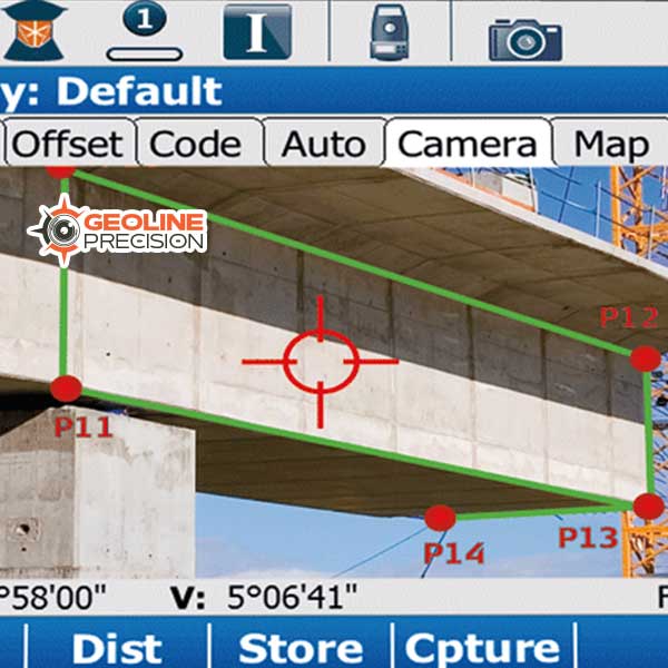
Leica Captivate Surveying Field Software
$ 0.00Leica Captivate is a user-friendly and customisable surveying field software that helps you tackle any measurement task. Whether collecting, viewing or sharing data, everything is done in one software with precise 2D views, 3D models and easy-to-use apps. Leica Captivate‘s industry and task-focused apps are designed for a range of measurement applications with Leica GNSS smart antennas, Total Stations and MultiStations, and the Leica AP20 AutoPole. In addition to enhancing the efficiency of data collection and use, Leica Captivate also empowers collaboration by supporting industry standard formats and data sharing via numerous cloud services.
-
Software
Leica Evidence Recorder
$ 0.00Leica Evidence Recorder, part of the Leica Geosystems Incident Mapping Suite, is the world’s best-selling evidence collection software built specifically for the crash and crime reconstructionist. This software allows users to review their measurements in 2D or 3D and confirm there are no errors or missing points before leaving the scene. Evidence is captured correctly and comprehensively every-time.
-
Software
Leica GeoMoS Adjustment Software
$ 0.00Construction sites, tunnels, mines, dams, slopes – wherever you need the most precise and reliable information on structural movement. Leica GeoMoS Adjustment allows you to make informed decisions based on statistically optimised and validated data.
-
Software
Leica GeoMoS Edge
$ 0.00Leica GeoMoS software suite now comes with the brand new Leica GeoMoS Edge, a monitoring software for autonomous sensor control and uninterrupted data logging in the field. GeoMoS Edge allows for measurements to be continuously taken and temporarily stored even when there is no communication to the office available – ultimately preventing data loss. It is embedded on the Leica ComBox60 and the Leica ComGate20, plug-and-play solutions for monitoring communication.
-
Software
Leica GeoMoS Monitoring Solution
$ 0.00For monitoring professionals who need to quickly understand and react to complex demands of today’s monitoring projects, Leica GeoMoS is a solution that provides needed flexibility to their projects. With scalable software, options and various licensing packages, Leica GeoMoS family adapts to specific needs of any user. Suitable for continuous or periodic projects, a complete monitoring solution is offered with the highest accuracy and reliability.
-
Software
Leica GeoMoS Now! Monitoring Service
$ 0.00Leica GeoMoS Now! is a web-based application that provides total, round the clock access to monitoring project data via any web-based device. Data is instantly available and users don’t require any previous knowledge of developing websites.
-
Software
Leica Infinity Surveying Software
$ 0.00Are you ready for simplified, seamless workflows? Are you ready for the only true, one-bridge solution between Leica field instruments and CAD software? Then you’re ready for Leica Infinity.
-
Software
Leica Map360
$ 0.00Leica Map360, part of the Leica Geosystems Incident Mapping Suite, is a crash and crime drawing software solution that lets users import, process, analyse, visualise and create court ready deliverables. Map360 provides crash and crime reconstructionist with multiple user interfaces for all skill levels and easy to use tools to visually communicate a scene and critical evidence. Import scenes of any size into Map360 from a wide range of sensors such as laser scanners, total stations and GNSS, to produce accurate 2D or 3D diagrams and animations.
-
Software
Leica SmartWorx Viva Field Software
$ 0.00Leica SmartWorx Viva is simple to learn and easy to use. With clear graphics, practical menu structures, understandable terminology and simplified workflows, it is designed to save you time and effort when completing survey and stake-out tasks.
-
Software
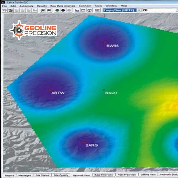
Leica SpiderQC GNSS Data Analysis Software
$ 0.00Leica SpiderQC is a multi-purpose GNSS data analysis tool that can be used for:
- Site Assessment and Quality Control
- Network RTK Performance Monitoring
- Reference Station Integrity Monitoring
- Deformation Monitoring
- RINEX data management (concatenation, decimation)
-
Software
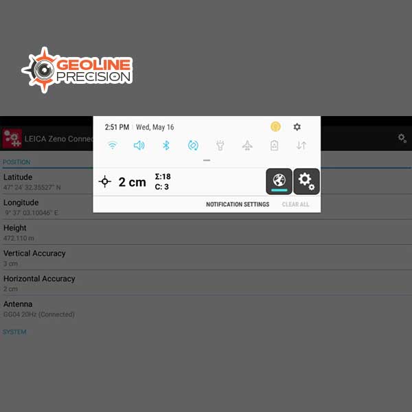
Leica Zeno Connect Software
$ 0.00Ready-to-deploy software
Leica Zeno Connect handles all communications between the GNSS receiver and the application, including the configuration of real-time differential correction sources. Leica Zeno Connect comes as an out-of-the box deployment. Simply install Zeno Connect, and the Zeno Connect toolbar always runs in the foreground of your application. -
Software
Leica Zeno Mobile
$ 0.00Leica Zeno Mobile is an Android app available on selected Android phones and tablets. The aim of Zeno Mobile is to keep things simple whilst still offering the user a host of professional data capture functions to increase productivity in the field.