GNSS Systems

-
Software
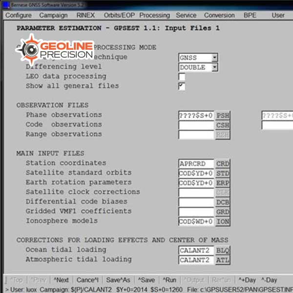
Bernese GNSS Software
$ 0.00The Bernese GNSS Software is the ideal tool for:
- Scientists researching in geodesy, meteorology and geosciences
- University study
- Survey agencies responsible for high-accuracy GNSS surveys
- Agencies responsible for maintenance of arrays of permanent GNSS receivers
- Commercial users with complex applications demanding high accuracy, reliability and high productivity
-
Software
GeoCloud Drive Cloud Storage and Data Transfer Service
$ 0.00GeoCloud Drive is a service within HxGN GeoCloud, a powerful cloud-based collaboration portal. Offering expanding services for optimising work and dataflows, HxGN GeoCloud is powered by HxDR, Hexagon’s cloud-native platform for geospatial solutions at any scale.
-
Software
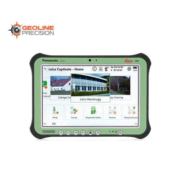
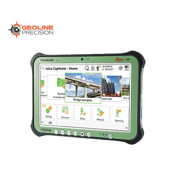
Leica Captivate Surveying Field Software
$ 0.00Leica Captivate is a user-friendly and customisable surveying field software that helps you tackle any measurement task. Whether collecting, viewing or sharing data, everything is done in one software with precise 2D views, 3D models and easy-to-use apps. Leica Captivate‘s industry and task-focused apps are designed for a range of measurement applications with Leica GNSS smart antennas, Total Stations and MultiStations, and the Leica AP20 AutoPole. In addition to enhancing the efficiency of data collection and use, Leica Captivate also empowers collaboration by supporting industry standard formats and data sharing via numerous cloud services.
-
Software
Leica Evidence Recorder
$ 0.00Leica Evidence Recorder, part of the Leica Geosystems Incident Mapping Suite, is the world’s best-selling evidence collection software built specifically for the crash and crime reconstructionist. This software allows users to review their measurements in 2D or 3D and confirm there are no errors or missing points before leaving the scene. Evidence is captured correctly and comprehensively every-time.